Selected Project
DPK Consulting Takes Site Investigation Data to a New Level!
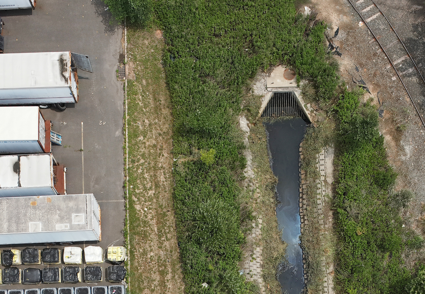
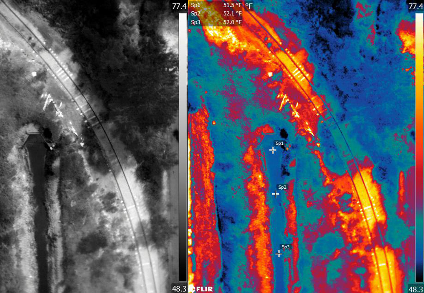
Using cutting-edge tech applications to their fullest, DPK Consulting integrated high resolution infrared sensors to their drones to capture and produce a comprehensive thermal survey. This data enabled their customer to better target potential contamination sources across this site.
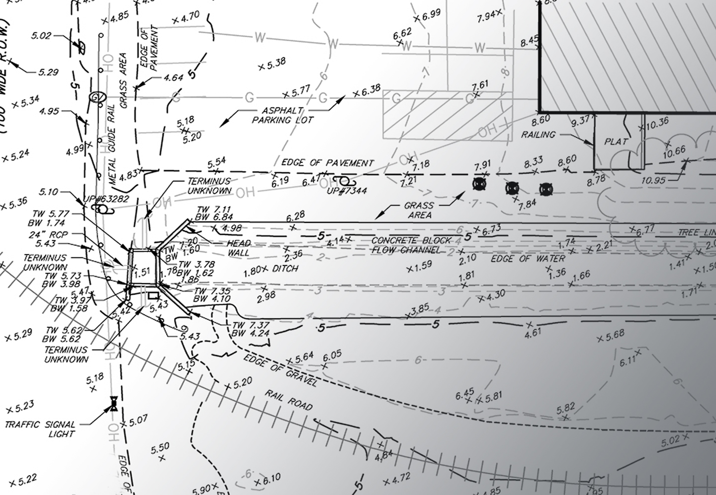
Technically known as a FLIR (Forward Looking Infrared) Drone Survey, DPK drones read temperature variations at ground level. Back in operations, their systems teams optimized this field data to help customers distinguish between groundwater and surface water. Coupled with a comprehensive topographic map, this data was instrumental in the planning and placement of well boring locations and depths supporting a more optimal approach for groundwater testing.
“We are working hard to share these amazing applications and capabilities with our environmental customers,” states James Heiser, CEO & President of DPK Consulting. “Our geospatial division has grown steadily as more and more customers recognize the expanded use of new tech and extraordinary value we are delivering. The comprehensive nature of 3D scanning and UAS technology multiplies the number field applications and deliverables we can offer. We’ve even provided geospatial data to help customers increase the comprehensiveness of their proposals. I believe our more visually intuitive data will not only help customers develop optimized approaches for remediation and speed site closures on the back end, but it will also enhance their business development efforts and ability to win more projects.”
DPK’s FLIR Drone Surveys work well year round. Because the thermal technology reads heat and not light, the opportunities to collect field data are greatly expanded. This helps DPK customers speed site investigations. Additionally, FLIR thermal sensors can detect tiny differences in temperature as small as 0.01 C and can display them in high contrast for easy identification and location targeting.
Take your site investigation and approach to remediating contaminated sites to the next level with DPK Consulting.
If you would like to discuss a project opportunity, please call 732-764-0100 and ask for Ray Hyman, or James Heiser. Or visit our convenient 24/7 Quick Quote page https://dpkconsulting.net/quick-quote/ to upload your SOW and site docs. A DPK project manager will respond promptly. Get your quote started today


