Selected Project
DPK Consulting’s Aerial LiDAR Generated 3D Model Helps Advance a Large Commercial Property’s Growth
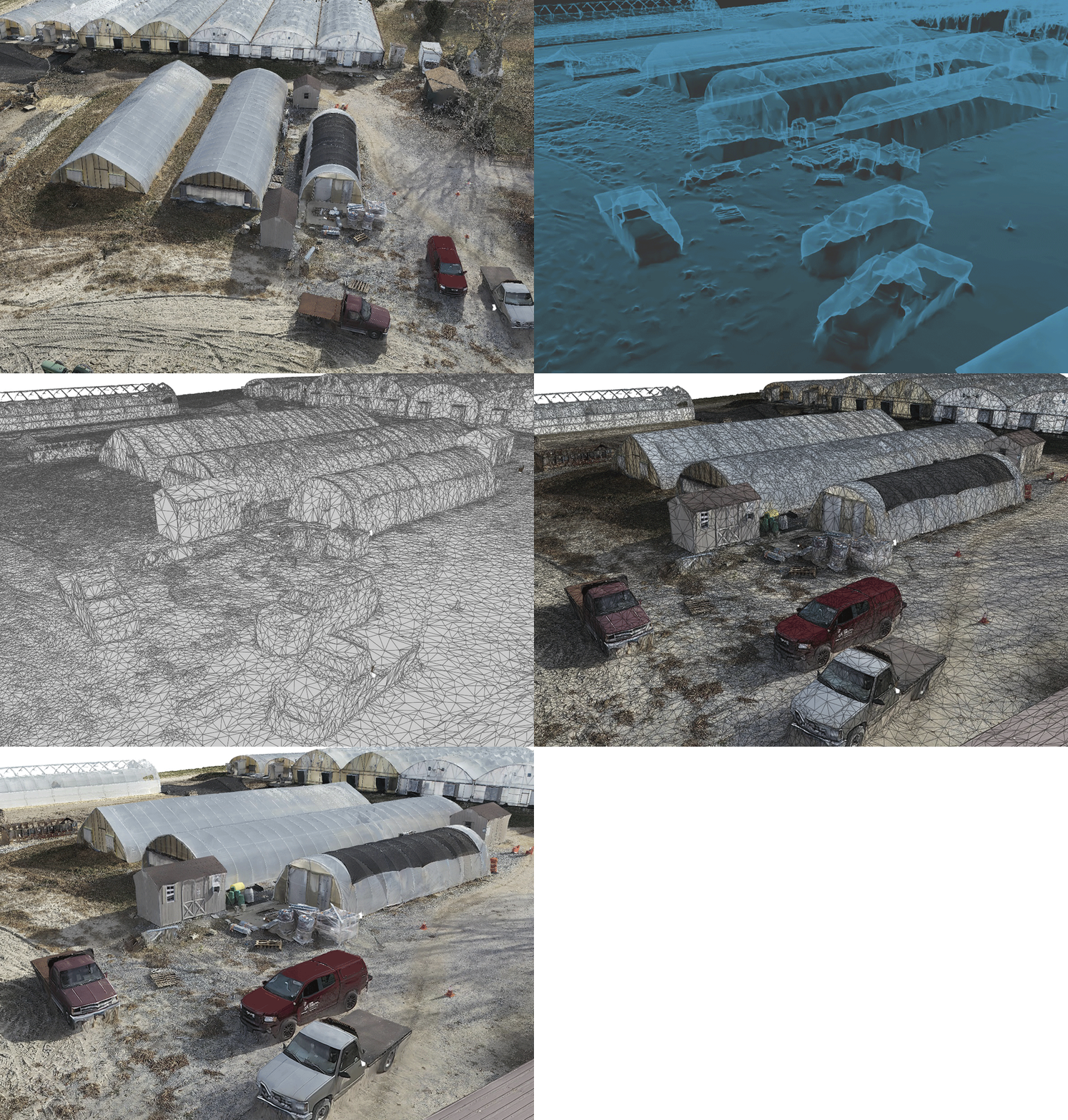
DPK Consulting was tasked with creating a Drone Survey, including aerial photography with LiDAR, a photogrammetric point cloud, and 3D mesh data that will be utilized for the planning of a new commercial greenhouse on an active commercial property in southern New Jersey.
DPK pilots mapped the course for the flight and executed flawlessly to collect the geospatial data required. With their sophisticated sensors, the DPK team was able to capture very high resolution information enabling them to build a beautiful 3D model.
Aerial drone mapping with LiDAR from DPK offers several benefits to commercial property owners planning to expand their facilities. Here are some of the key advantages:
- Accurate Site Surveys – high precision and comprehensive data
- Cost-Effectiveness – reduced labor costs and fewer site visits
- Speed and Efficiency – faster Data Collection and rapid turnaround
- Improved Planning and Design – detailed 3D models and better visualization
- Risk Mitigation – identify Potential Issues and compliance with regulations
- Sustainability and Environmental Considerations – minimizes impact and improves environmental assessment
- Enhanced Communication and Collaboration – shared data and improved decision-making
All property data and the final plan were made accessible to the customer through DPK’s convenient web portable which makes file reviews and deliverable downloads secure and simple.
DPK Consulting is using their geospatial and remote sensing technology to serve multiple industries, including land development, engineering, construction, environmental assessments and investigations, and various site remediation phases. The applications, value and efficiencies created by drone technologies are ever increasing.
To discuss your next project, call 732-764-0100 and ask for James Heiser or Ray Hyman. Alternatively, visit our 24/7 Quick Quote page at DPKConsulting.net/quick-quote to upload your scope of work and site reference documents. A DPK project manager will respond promptly.
Get your quote started today!


