Selected Project
DPK Consulting’s Blend of Traditional and Cutting-Edge Surveying is Highly Valued at Paterson’s 19th Century Manufacturing Property
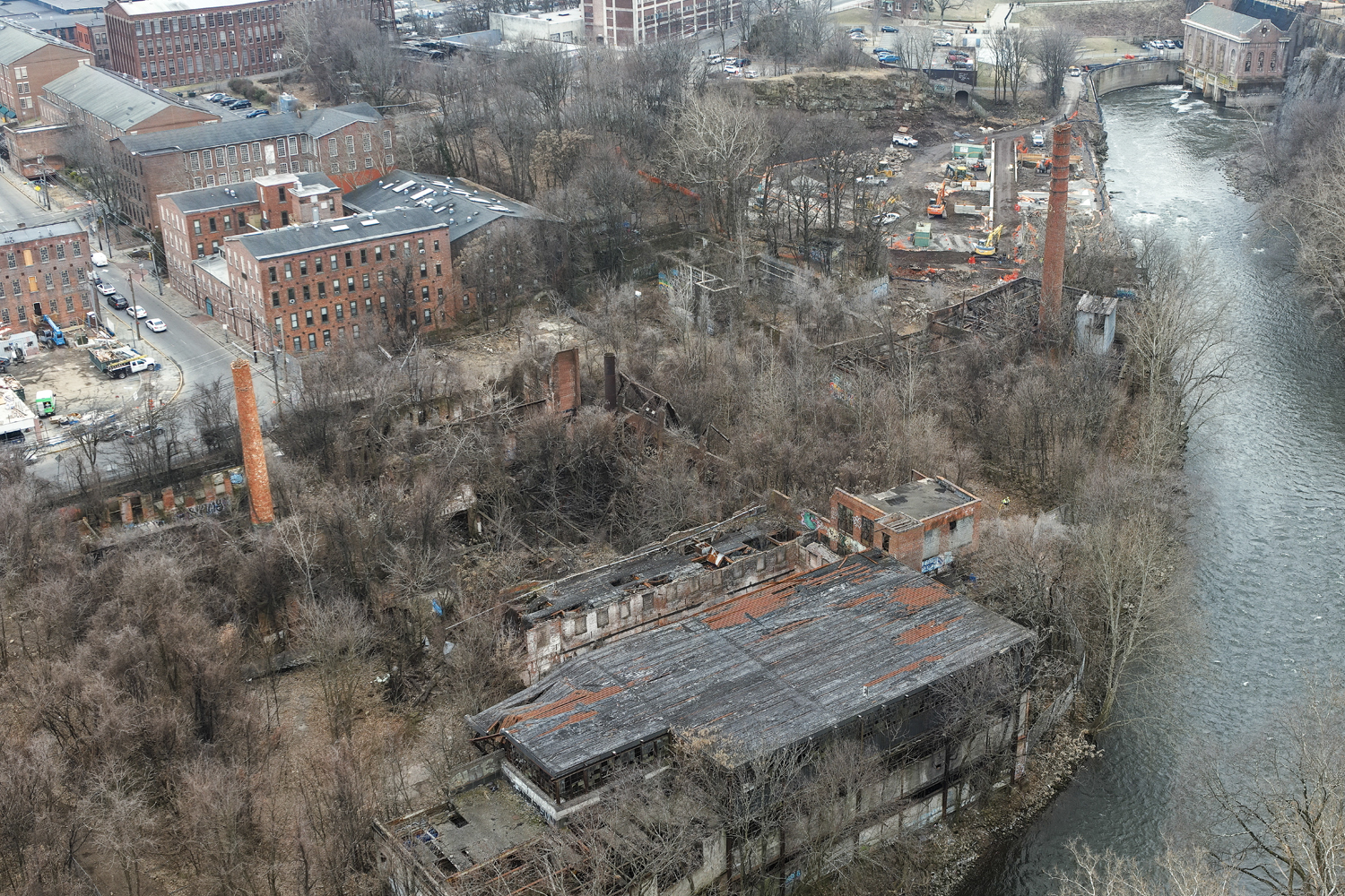
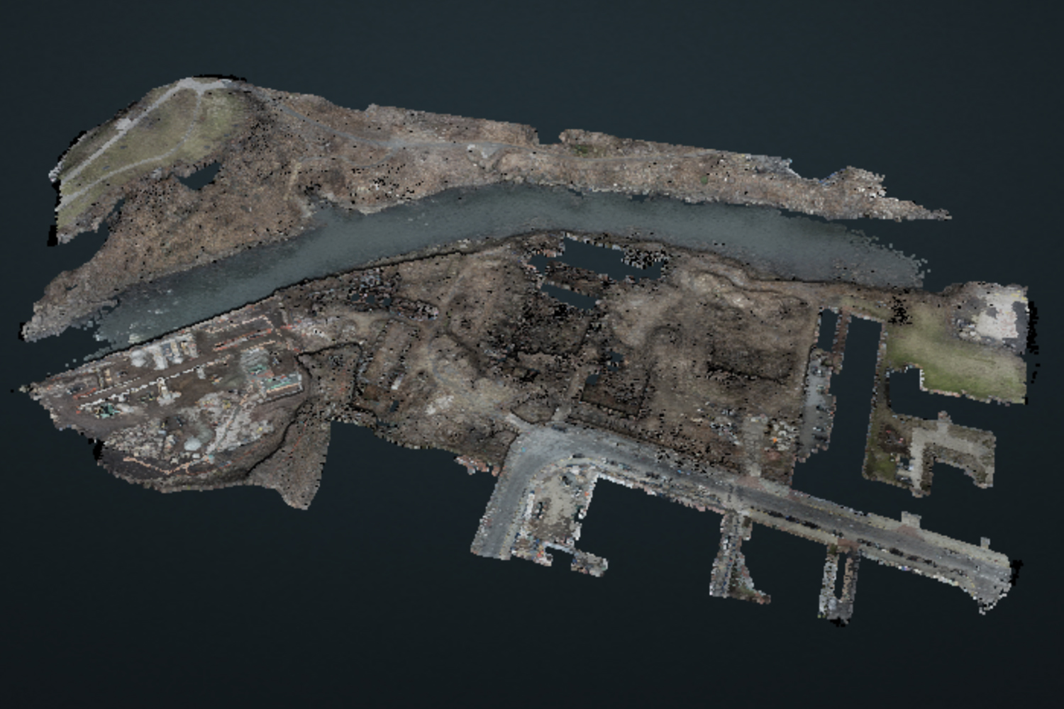
Without a drone and skilled pilot, the relics of a bustling economy are barely noticeable today at this abandoned manufacturing compound near the Great Falls of Paterson, NJ. The first silk manufacturer was established here in 1840. By the 1880’s, Paterson was producing nearly 50% of countries silk and had earned a nationwide reputation as “Silk City”. This manufacturing powerhouse survived labor strikes and the Great Depression, but its antiquated mills eventually gave way to modern techniques and the invention of the artificial silk Rayon.
Fast forward to today and multiple entities are coordinating and collaborating. DPK’s reputation as a high quality surveyor and their proficiency with new UAV technology has made them an ideal choice to support a broad scope of services contributing to the transition and advancement of this project.
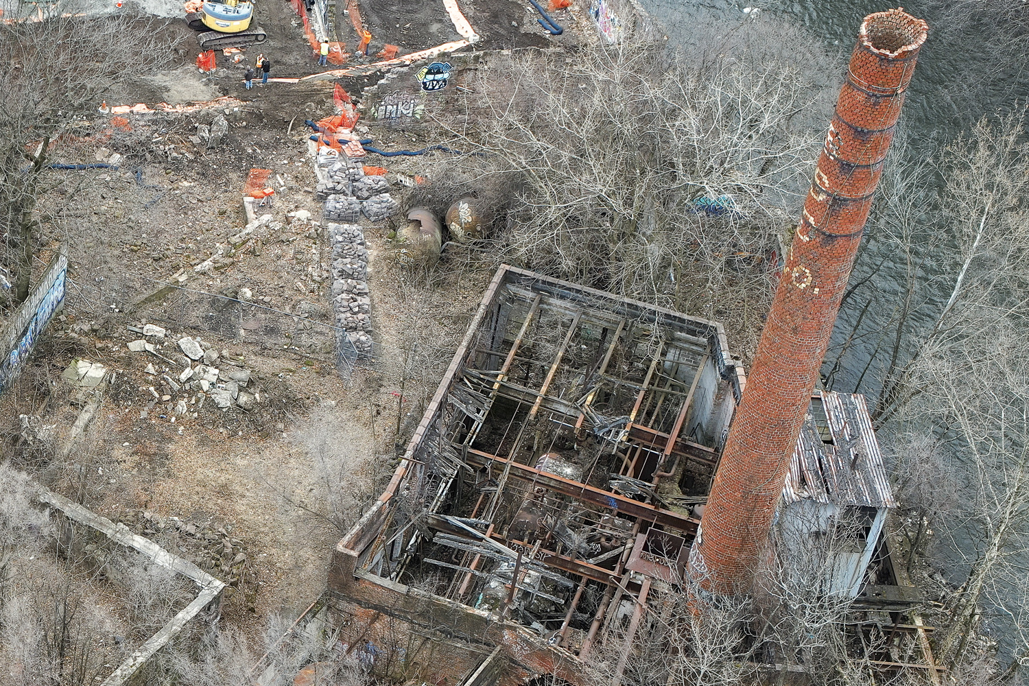
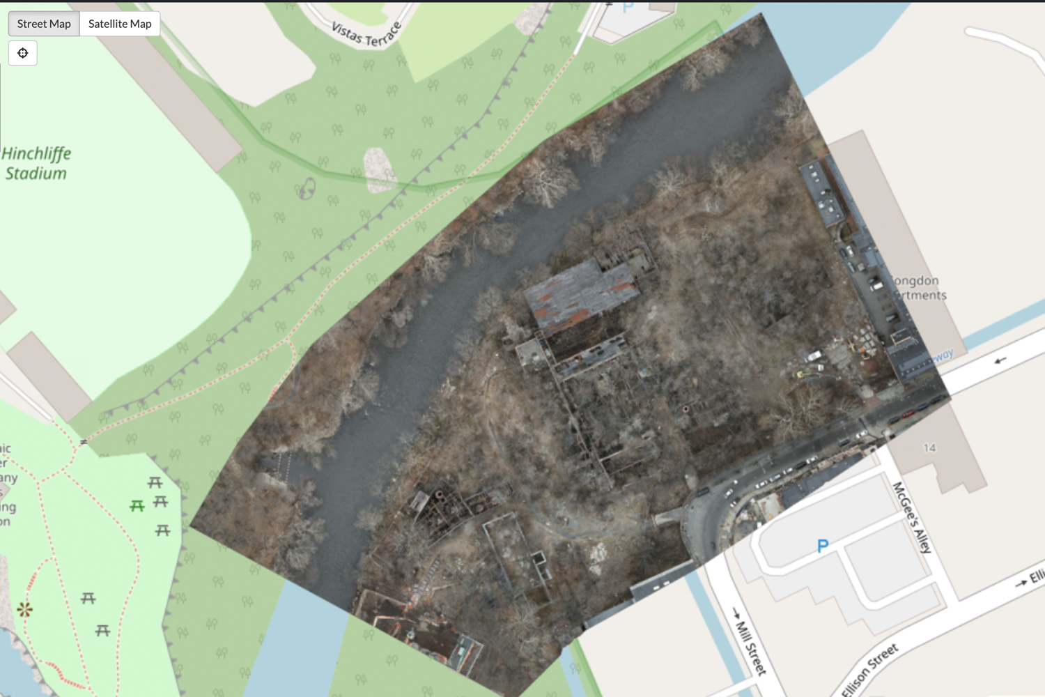
For example, DPK utilized traditional methods to map all site infrastructure such as the property boundary, roads, and utilities. DPK also provided Drones, Pilots, and 3D scanning technology to monitor and delineate large fill piles from the demolition of the remaining plant structures. The incredible granular detail DPK captured of demolition debris was an important component in costing the management, transportation, and disposal of such a wide variety of materials. DPK’s health & safety training and certifications were of particular value given the hazardous nature and lose material prevalent across this site.
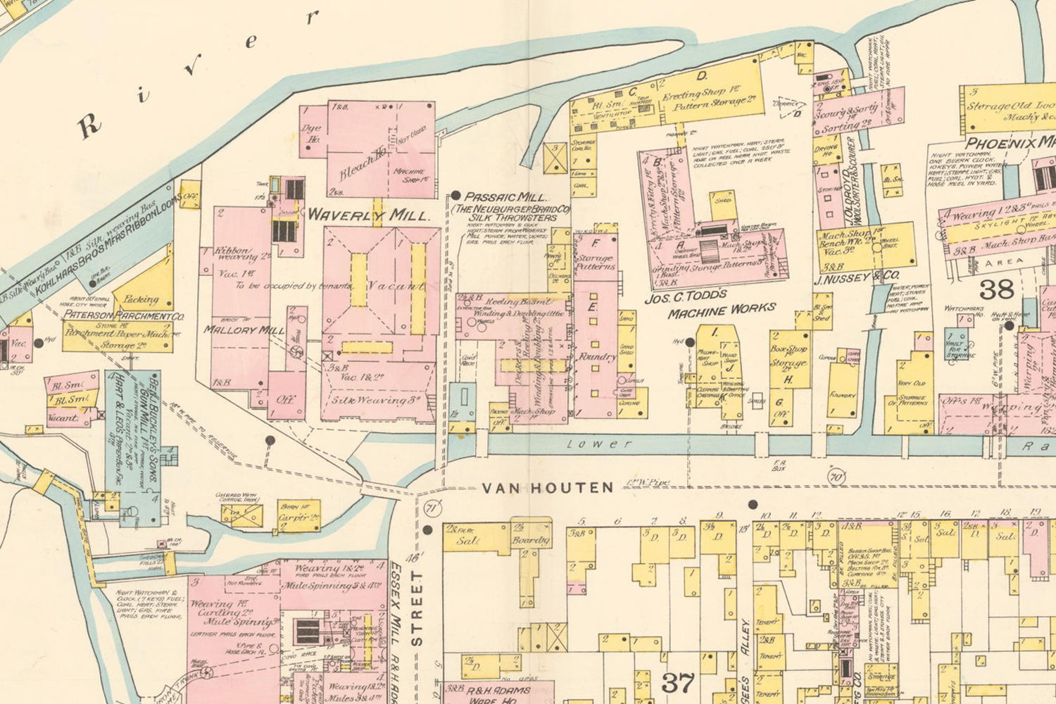
Another unexpected challenge was the age and amount of time this property has been abandoned. There were only old city maps to use a reference to begin retracing the boundaries of the property. In fact, DPK even referenced antique Sanborn maps dating back to the 1860s.
“Looking back at all of the historical site features really helped us make sense of the conditions”, states James Heiser, President & CEO of DPK Consulting. “ We were able to develop a new and very solid base map for the client, as well as finite detail with regard to material within the debris piles. Our broad services platform was of great value as this site required unique data for a variety of project components. Having expertise in traditional survey and the latest in digital technologies gave us a leg up as a contractor. We really separate ourselves on complex projects like this and take care of an extraordinary number of deliverables. This a benefit to our customers as it reduces the number of subs they need to manage.”
According to Mr. Heiser, the old Sanborn maps were incredibly interesting as they not only showed roads and property assets, but also list all of the different owners and the types of facilities they were. They illustrated the resourceful man-made water channels powered by the Passaic River –and labeled them “Lower Race”. These waterways were used to move materials and product around the maze of factories.
LEARN MORE ABOUT DPKs BROAD RANGE OF SERVICES by calling James Heiser or Ray Hyman at
732-764-0100. From traditional surveying to the latest geospatial technology, such as 3D scanning and powerful drones, DPK creates an approach that delivers value beyond the initial scope of work.


