

EPA defines “All appropriate inquiries” as a process of evaluating a property’s environmental conditions and assessing potential liability for any contamination. All appropriate inquiries must be conducted to obtain certain protections from liability under the federal Superfund Law (CERCLA). The specific reporting requirements for all appropriate inquiries are provided in 40 CFR §312.21 §312.31 of the final rule. The results of the inquiry are typically documented in a Phase 1 Property Environmental Site Assessment. Recommendations for the conduct of a Phase 1 ESA are published in ASTM E1527-13, Standard Practice for Environmental Site Assessments: Phase I Environmental Site Assessment Process and contain requirements for a records review, including historical aerial photography, a site inspection, and surrounding area survey. The Phase 1 ESA “shelf life” is generally good for 180 days. Thereafter, it should be updated including a new visual inspection.
Those in the environmental profession will agree that it is extremely fortuitous to find a historic aerial photo that is younger than 180 days. Prior to the advent of unmanned aerial systems (aka “drones”), with their HD cameras and sensors, the cost of commissioning an aerial survey of a property was prohibitive. After all, these costs are generally not recoverable if the property transaction falls through, as the prospective buyer usually incurs the cost up front. This all has changed. With the advent of FAA Part 107 authorization, the use of UAS for property inspection has expanded rapidly and is already standard accepted practice in the residential and commercial real estate markets.
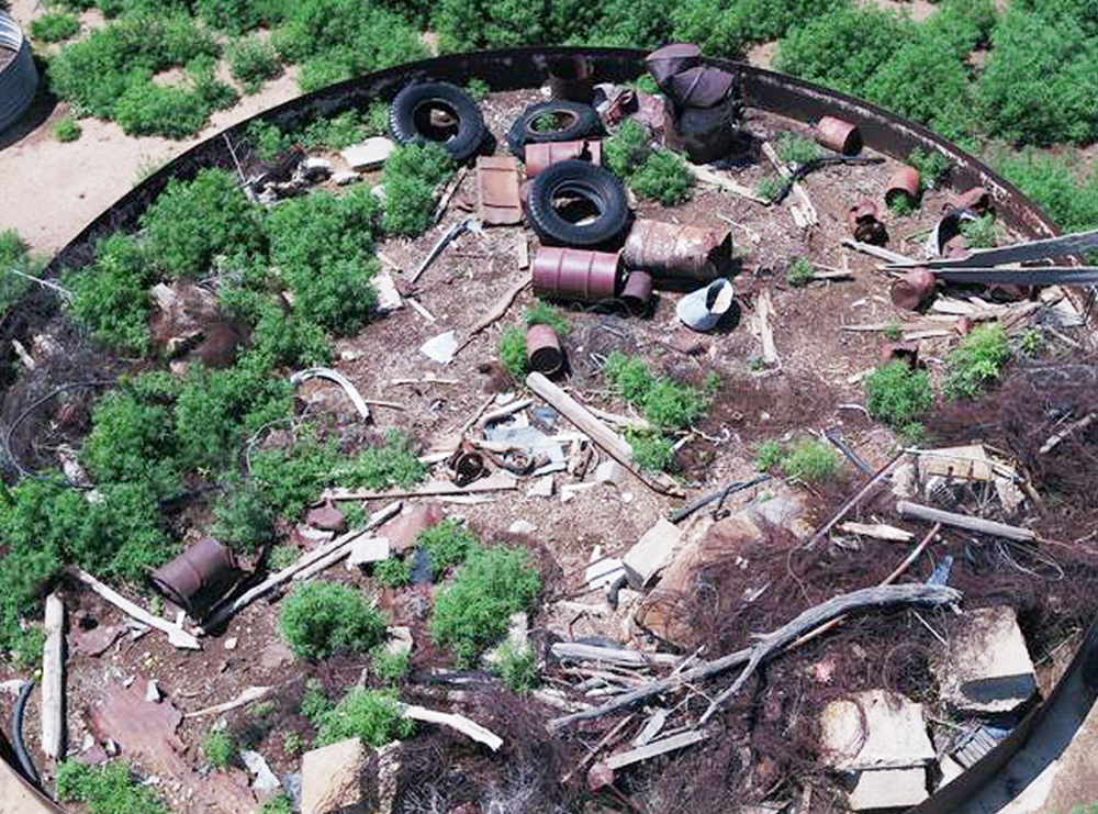
The application of UAS surveys for Phase 1 ESAs is invaluable. Not only does one obtain a “bird’s eye view” of the property, but the drone can also be used to fly into areas where environmental professionals have limited access, due to either the size or condition of the subject property, barriers to vehicular or pedestrian access, dense vegetation, wetlands or natural hazards.
Combining the HD photography with digital photogrammetry solutions and remote sensing devices opens a completely new vista for the environmental due diligence practice. Application of photogrammetry permits the construction of high resolution 2D and 3D maps, digital elevation models and georeferenced orthomosaics that can be output as geotagged imagery, GIS Data (KML, SHP, etc.), 3D Point Cloud Data (LAS) or highly accurate CAD outputs (DXF, DWG, etc.). The work product can be overlaid by maps of thermal and spectral sensor data to identify factors potentially indicative of environmental degradation not visible to the human eye. Should the property evaluation and purchase proceed, the same drone assets and reference datum can be used for more refined investigation, ecological resource impact assessment, cleanup of contaminated hot-spots, redevelopment planning, building construction management, safety auditing and post construction asset management.
Having undertaken multiple UAS surveys as part of Phase 1 ESAs, including properties encompassing tens of thousands of acres and hundreds of miles of transmission assets, we can state unequivocally that this technology is a game changer for the environmental industry as we continuously look to improve how we work to better serve our clients and to produce the best quality product possible while remaining cost competitive. Best of all, is the sheer joy of watching our valued clients jump with excitement as the data feed streams live from our aerial platform to our mobile data center, allowing them to refine the view in real time, and target areas of concern for refinement of the tactical mission while boots are still “on the ground.” By that measure, the technology is priceless.
Putting a drone in the air over an environmental site is something that every consulting engineer or environmental services firm should be planning to do in 2022 if they haven’t already. CALL James Heiser or Ray Hyman at DPK Consulting and learn more about the effectiveness and efficiencies of drone-based services at 732-764-0100.